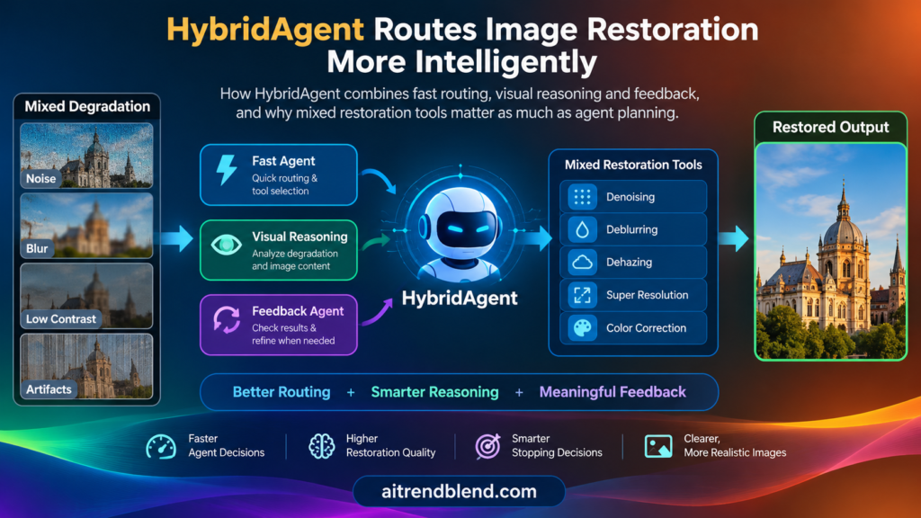
HybridAgent Routes Image Restoration More Intelligently
A photographer opens a dim, grainy image and types a simple request to make it clearer. Another user knows exactly what is wrong and asks only for noise removal. Sending both requests through the same expensive visual reasoning pipeline wastes…
HybridAgent Routes Image Restoration More Intelligently Read More »